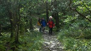
The locality abounds in amenities and many places of historical and literary interest. The modern Ballymacmoy House, the home of the Hennessy Brandy family is located on the cliff, high above the River Blackwater and Edmund Burke (1729-1797) received some of his early education in the area. This loop incorporates a short section of the Blackwater Way (a long-distance route) before ascending woodland paths and forest roads towards Corran Mountain (the third highest mountain in the Nagles Mountain range). On gaining higher ground, the walker is treated to some excellent views over the Blackwater Valley, Ballyhoura Mountains and Nagle Mountains.
A-B. Starting from the roadside car park, follow the purple arrow onto a leafy woodland path. You are also on the Blackwater Way marked with yellow arrows and trekking man logo. After 300m you reach an uphill path on your left. This is where your loop rejoins the woodland path on your return journey. Continue straight at this junction.
B-C. Follow the woodland path for another 200m to where the Blackwater Way turns right onto a downhill path. You continue straight here – following the purple arrows which will guide you around the remainder of the loop. Continue to follow the path for a further 400m to exit onto a forest track where you turn left.
C-D. Continue along the forest track to reach a T-junction where you turn right and then begin the ascent towards Corran Mountain. As you ascend views open up on your right of the Avondhu region and the Boggeragh Mountains. After 3km the loop reaches it’s highest point (400m) at a forestry track which leads uphill to the summit of Corran and a metal mast. Continue straight here.
D-E. The loop now begins to descend, gently for the first 1km, to reach a grassy track on the left near a right bend. Turn left onto the grassy track and follow along the edge of the forestry (on your right) for 600m to reach a narrow woodland path going downhill to your right. Take this path for a brief 200m to exit again onto a forest track where you turn left.
E-F. The loop continues its gentle descent – good views of the Blackwater Valley opening up in front and to your right. After almost 3km you reach a ‘crossroads’ of forestry tracks where you turn left.
F-A. The loop ascends briefly before turning right into woodland and then follows a series of paths downhill to eventually reach the wooden log barrier at the junction mentioned at B above. Turn right here and enjoy the remaining 300m back to the trailhead.
Trail details
- Type:
- Walking Trail
- Location:
- Killavullen
- Grade:
- Moderate
- Format:
- Loop
- Length:
- 11.90km
- Ascent:
- 480m
- Dogs allowed:
- No
In Killavullen: Minimal
Parking is available at the graveyard at the start of the route. It's a 12km hike that encompasses part of the Blackwater Way.
