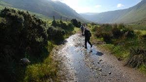
A seven-day loop in total, the terrain is mainly quiet tarmac roads, mountain, field and cliff paths, as well as some 20km of good beach walking. About 6km of the total 162km follows local roads.
A strenuous trail, The Dingle Way’s aggregate ascent is 2,590m, and although there are some short steep ascents, there are no significantly steep climbs.
Beginning and ending in lively Tralee, you’ll climb the flanks of Slieve Mish, cross the captivating Dingle Peninsula over to windswept Inch Beach and westward to Anascaul, Lispole and Dingle.
The trail’s most dramatic leg comes west of Dingle, becoming a charming coastal trek around Ireland’s most westerly point. The return leads you below impressive Mount Brandon, The Kingdom’s holy mountain, and back to Tralee along the shore.
With plenty of overnight accommodation en route, there’s no shortage of welcoming towns and villages on the delightful Dingle Way.
Trail details
- Type:
- Long Distance Waymarked Way
- Location:
- Tralee Dingle
- Grade:
- Strenuous
- Format:
- Loop
- Length:
- 162.90km
- Ascent:
- 2590m
- Dogs allowed:
- No
At Start/Finish - in Prince's Street car park in Tralee (charge)
- The Dingle Peninsula stretches almost 50km into the crashing Atlantic Ocean. This loop effortlessly showcases its diverse landscape of coastal plains, sandy beaches, mountains and lakes.
