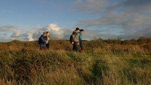
The remote and rugged north coast of Mayo is one of Ireland’s best kept secrets. Many of its majestic cliffs, rugged headlands, rocky coves and jagged stacks are apparent only to those who are willing to walk away from the main thoroughfares to discover them. The Dun Chaocháin area is one of great physical beauty and has retained many of its old traditions and culture - the Irish language is still in full vigour as the vernacular. The spectacular Dun Chaochain cliffs have featured in various walking guidebooks including Lonely Planet - Benwee Head at 255m is the crowning glory. The Stags of Broadhaven (a group of four precipitous rocky islets rising to almost 100m) are located about 2km north of Benwee Head and are a site of ornithological importance. This loop incorporates the Children of Lir sculpture - the well-known legend tells the tale of children who were turned into swans and condemned to wander the countryside for 900 years. The key feature of the loop is the black ditch – a dry ditch which runs parallel to the coastline and clifftops and probably marked the boundaries of lands in previous times.
A-B. Starting from the car park at the Seanscoil (old school) follow the red arrow (and green and blue arrows) along Bothair an Iochtair. The green and blue arrows are for shorter loop walks which will leave your loop as you progress. Continue to follow the red arrows downhill, onto a sandy roadway and to a junction with a tarred roadway. To your left is Binroe Point – you turn right here.
B-C. Follow the tarred roadway uphill for approximately 200m before turning left at a wire fence
– note that the shorter green loop continues along the roadway here.
C-D. After leaving the roadway follow a track along fences and through some gates to join the black ditch. Follow this feature parallel to the shoreline and then sharp right and uphill onto the clifftop at Alt Breac.
D-E. Leaving Alt Breac the loop follows the clifftop via Bun a Ghleanna, An Lair Bhan, and Lag Fliuch to reach the Children of Lir monument at An Priosuin (the Prison).
E-F. From here follow the red arrows uphill towards Benwee – noting that the blue loop follows the roadway as it makes its way back to the trailhead. After a fairly demanding ascent you reach a stream called An Fiodan Dubh. Turn right here and follow along the edge of the stream to its conclusion and cross a short section of bogland to join the head of a bog road. Turn right here.
F-A. The loop now begins to descend along the bog road to rejoin both the green and blue loops at a crossroads less than 1km from the trailhead. Turn left and enjoy the last section through Stonefield to the trailhead.
Trail details
- Type:
- Walking Trail
- Location:
- Carrowteige Loop Walks
- Grade:
- Moderate
- Format:
- Loop
- Length:
- 10.90km
- Ascent:
- 270m
- Dogs allowed:
- Yes
