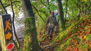
Taking five days to complete, the Miner’s Way and Historical Trail are waymarked long-distance walking routes over counties Roscommon, Sligo and Leitrim.
Unfolding over quiet tarmac roads, field paths, open moorland and forestry paths, this strenuous figure-of-eight walking route starts and ends in Arigna, County Roscommon. Some 60km of the trail’s total 144.6 km follow local roads. The route’s aggregate ascent is about 2,376m.
A varied trail, it showcases the counties’ lakeland charm by skirting Lough Allen, Lough Arrow and Lough Key. Walkers will enjoy mountain landscape too while crossing the rugged low ranges of Corry Mountain, the Curlew Mountains and the Bricklieve Mountains.
The area’s overnight accommodation is good, should you take on the whole captivating loop, while towns and villages like Keadue, Boyle, Arigna and Drumshanbo provide warm welcomes and refreshment for those taking shorter sections.
Trail details
- Type:
- Long Distance Waymarked Way
- Location:
- Arigna Dowra Dromahair Drumshanbo Boyle
- Grade:
- Strenuous
- Format:
- Loop
- Length:
- 144.60km
- Ascent:
- 2376m
- Dogs allowed:
- No
At Start - large car parking area near pub at start of Way in Arigna
At End - on street in Drumshanbo or at Sliabh an Iarainn Visitor Centre
- The Miner's Way owes its name to the coal mining which took place in the Arigna Mines up until recent times. It follows the paths the hardy miners travelled on their journey to work.
- The Arigna Mines were utilised for over 400 years to extract iron and coal for industry. Although many of the entrances to this old network of underground mines remain open – these are dangerous and should be avoided.
